Spatially Uneven Coastal Risk in Port Dickson: Evidence from Shoreline Households
Keywords:
Coastal hazards, household vulnerability, risk perception, Port Dickson, community stewardshipAbstract
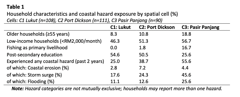
This study develops a policy-facing, non-causal social profile of shoreline households in Port Dickson, Negeri Sembilan, by reading exposure, private recovery burden, perceived risk, public support, and stewardship behaviour together across three coastal spatial cells Lukut C1, Port Dickson Town C2, and Pasir Panjang C3. Using a household survey of 309 respondents and transparent comparative tables, we assess spatial heterogeneity and apply Pearson chi-square tests for key categorical outcomes. Results show marked within-district differences: C3 concentrates older and lower-income households, lower educational attainment, higher fishing dependence, and the highest reported hazard experience, especially storm surge and flooding. Repair and clean-up costs among affected households are often substantial and concern is widespread, with the highest high-concern share in C3. Support for shoreline protection is near-universal, and volunteering is high, with deepest engagement in the most exposed locality. Findings support vulnerability-sensitive coastal planning that prioritises high-burden hotspots while mobilising local stewardship capacity.